
Yonaguni Monument (Underwater Ruins)
Unverified
Explore Yonaguni Monument in Okinawa, Japan, a mysterious underwater formation known for massive terraces, geometric walls, strong currents and its debated origin.
Overview
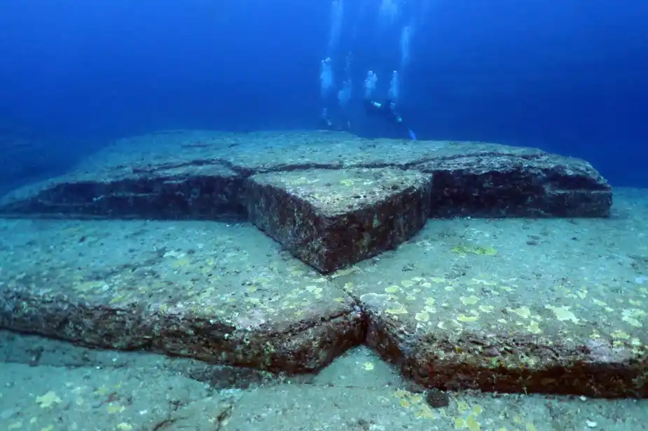
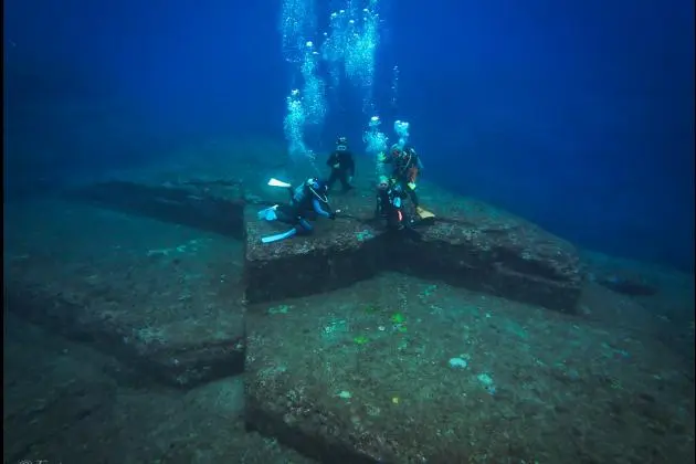
Yonaguni Monument is one of the most unusual and controversial dive sites in the world. Located approximately 100 metres off the southern coast of Yonaguni Island in Okinawa, Japan, the enormous submerged rock formation is famous for its broad terraces, steep walls, straight-looking edges and staircase-like structures.
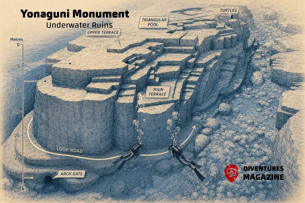
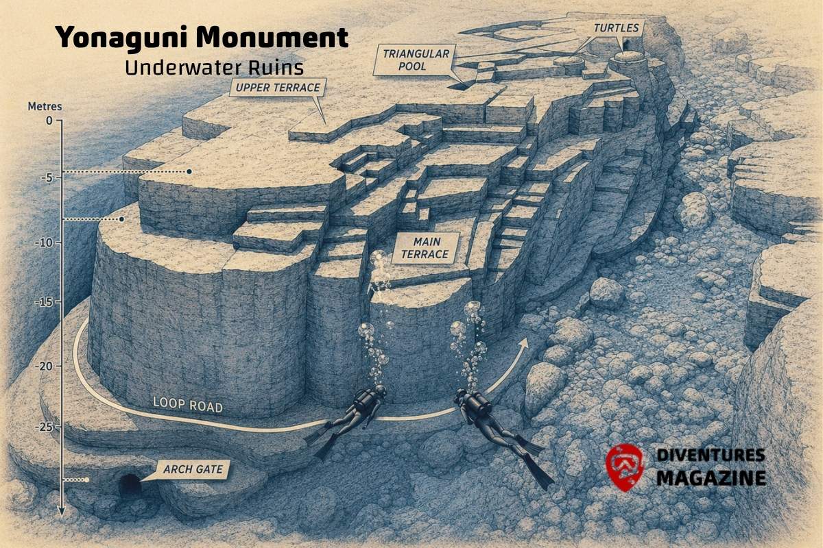
The main formation measures roughly 100 metres long, 60 metres wide and 25 metres high. Its upper sections reach to approximately five metres below the surface, while the deepest parts of the normal dive are around 25 metres.
Since its discovery by local diving operator Kihachiro Aratake in 1986, the site has generated an extraordinary debate over its origin. Some researchers have argued that its terraces, steps and angular forms show evidence of human construction or modification. Others conclude that the formation is natural, created through erosion and fracturing of layered sandstone in a tectonically active area.
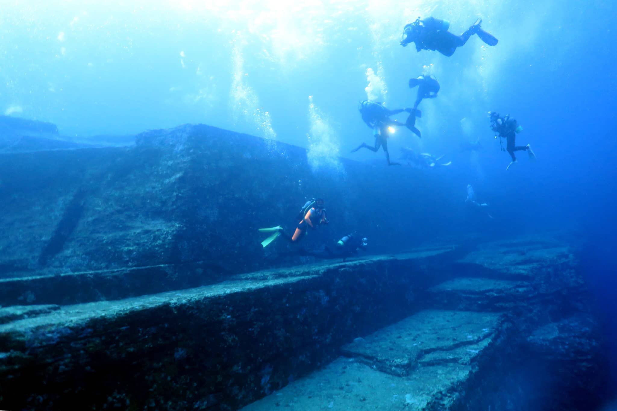
For divers, the scientific debate is only part of the attraction. Swimming beside the enormous Main Terrace, narrow channels and geometric-looking walls creates an experience unlike a conventional coral reef.
Yonaguni’s location in the open western Pacific also means that conditions can be demanding. Currents may become strong, and diving is normally conducted from boats as a drift. Although the structure itself is relatively shallow, divers should be comfortable with current, controlled descents and boat pickups.
Whether viewed as an extraordinary geological formation or something potentially modified by ancient people, Yonaguni Monument remains one of diving’s great underwater mysteries.
Main Attractions
The main formation measures approximately 100 metres by 60 metres and rises around 25 metres, giving it the appearance of a monumental submerged structure.
Extraordinary step-like underwater rock formation
Massive flat terraces
Sharp-looking geometric edges
Vertical walls and channels
Main Terrace
Stair-like formations
Passageways and narrow channels
The feature known as The Turtle
Approximately 25-metre-high main formation
One of diving’s most debated geological sites
Excellent wide-angle photography
Possible turtles, moray eels and pelagic fish
Seasonal hammerheads in the waters around Yonaguni
Marine Life
Around the monument itself, divers may encounter:
Sea turtles, moray eels, butterflyfish, anthias, surgeonfish, wrasses and other subtropical reef species.
The wider waters around Yonaguni are also famous for barracuda, dogtooth tuna, bigeye trevally and other pelagic fish. Scalloped hammerheads are a major seasonal attraction around the island, particularly from approximately November through early May, but the principal hammerhead dives occur at other Yonaguni sites rather than at the Monument itself.
Coral & Habitat
Unlike many famous tropical dive sites, Yonaguni Monument is primarily a geological rock formation rather than a coral reef.
The formation consists largely of sandstone and mudstone bedrock characterised by horizontal bedding planes, vertical fractures, terraces, straight-looking edges and broad flat surfaces. These geological characteristics are central to the debate over whether the structure was formed entirely by natural erosion or modified by humans.
The main mass rises approximately 25 metres from the surrounding seabed and contains large platforms, abrupt walls, channels, steps and angular projections.
Marine growth is present on the rock, but the dominant visual feature is the enormous exposed stone structure rather than dense coral coverage.
Wreck Information
There is no wreck associated with the standard Yonaguni Monument dive.
Despite the commonly used name “Underwater Ruins,” there is currently no accepted archaeological evidence establishing the formation as the remains of a sunken city.
The attraction is the rock formation itself and the continuing debate over its origin.
Suggested Route
Monument circuit
Enter from the boat on the side selected by the local guide according to the current.
Descend toward the upper section of the formation at approximately 5–10 metres and approach the large stone structure.
Follow the natural passage through the formation before reaching the Main Terrace, one of the site’s most recognisable features.
Continue alongside the broad flat platforms and large vertical faces, passing the staircase-like formations, channels and angular rock structures.
Depending on current and remaining gas, continue around the deeper side of the structure toward approximately 20–25 metres before gradually returning to shallower water.
Allow the current to carry the group away from the monument when required, deploy a delayed surface marker buoy and complete the safety stop before boat pickup.
Because currents around Yonaguni can change rapidly, the Dive Guide map should not show a fixed directional dive route. The exact entry point and direction should always be determined by the local dive guide.
Photography Notes
Yonaguni Monument is an exceptional wide-angle photography site.
The Main Terrace, enormous vertical faces, staircase-like formations and sharp geometric perspectives can be photographed with a diver included for scale. Without a diver in the frame, it can be difficult to communicate the enormous dimensions of the structure.
A fisheye or very wide rectilinear lens is ideal for capturing the terraces and walls.
The clearest compositions often come from positioning slightly away from a vertical face and using the blue water as negative space. The contrast between straight-looking stone edges and open water gives the site its distinctive visual character.
Strong currents may make it difficult to stop or move backward for a composition. Camera settings should therefore be prepared before entering the exposed sections of the site.
History
The Yonaguni Monument was discovered in 1986 by local diving operator Kihachiro Aratake while exploring waters off the southern coast of Yonaguni Island. Its huge terraces, straight-looking edges and staircase-like formations quickly generated international interest.
One interpretation, associated particularly with geologist Masaaki Kimura, proposes that the site was constructed or substantially modified by humans and could represent the remains of an ancient settlement.
Other geologists have argued that the formation can be explained by natural geological processes. Yonaguni’s sandstone contains horizontal bedding planes and vertical joints that can fracture into angular shapes, while erosion, waves, earthquakes and strong currents can progressively produce terraces and straight edges. A 2019 geological study cited in later reviews supported natural weathering and erosion along sandstone bedding and joints as an explanation for the formations.
Whether Yonaguni Monument is entirely natural or bears evidence of human modification remains a subject of debate. No accepted archaeological evidence currently establishes it as the ruins of a lost civilisation.
Best Season
March, April, May, June, July, August
Site Diagram